

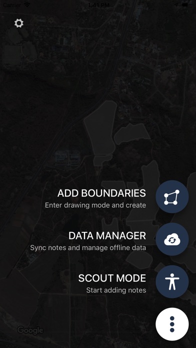

Aeroview Scout
Aeroview Scout allows farmers to walk their fields capturing ground-truth data for problem identification and tracking.
Aeroview Scout allows you to:
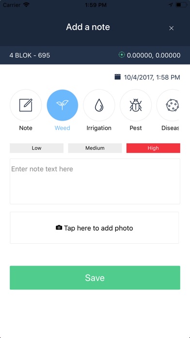
- Identify and monitor various diseases, pests, weeds or irrigation problems.
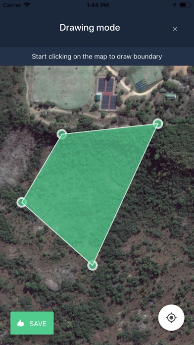
- Place GPS markers at locations on a map with notes and photographs.
- Take your drone-captured data into the field with you.
- Download your data at home to use in field where cellphone signal may be low.
- Integrate your scouting data with our online web application Aeroview.
* Drone-captured data can be uploaded and stitched on Aeroview.